Eine Point-Geometrie erstellen
Der Eiffelturm ist ein Eisenturm aus dem 19. Jahrhundert und vermutlich das bekannteste Wahrzeichen von Paris.
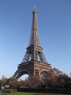
(von couscouschocolat [CC BY 2.0], via Wikimedia Commons)
Die Lage des Eiffelturms ist: x = 255422,6 und y = 6250868,9.
Diese Übung ist Teil des Kurses
<Kurs>Arbeiten mit Geodaten in Python</Kurs>Übungsanweisungen
- Importiere die Klasse
Pointaus shapely. - Erstelle ein shapely-Point-Objekt mit den Koordinaten des Eiffelturms und weise es einer Variablen namens
eiffel_towerzu. - Gib das Ergebnis aus.
Interaktive praktische Übung
Versuche dich an dieser Übung, indem du diesen Beispielcode vervollständigst.
# Import the Point geometry
from ____.____ import ____

# Construct a point object for the Eiffel Tower
eiffel_tower = ____

# Print the result
____